About Coswin GIS
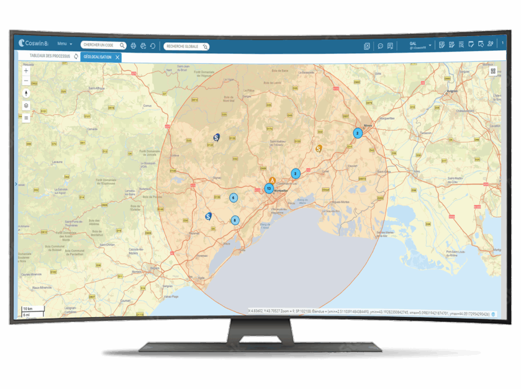
The integration of Esri’s ArcGIS GIS (Geographic Information System) software into Coswin 8i CMMS enables you to position and geolocate your assets, employees and interventions.
Product benefits
Coswin GIS allows you to :

View public maps in your CMMS application

Access map objects from a CMMS device

Navigate, call up equipment details, JR/WO linked to the map object

Open your BIM model from the map

Display your private maps (ArcGIS GIS)
Advantages :
Fully integrated with Coswin 8i, no need to open third-party applications

Using your published proprietary maps/layers

Visualisation in Coswin of metadata associated with GIS objects

Notification of employees to job requests and work orders on the map
Choose Coswin GIS
Ergonomic
Simplified integration
Powerful
Dynamics
Directly viewable in Coswin 8i, no need to open a third-party application. Customizable markers.

A correspondence table between the objects in your catography and your equipment database simplifies operation.

Card display functions; links with Coswin functionalities (Equipement, di, ot), card-based transaction creation.

Connected to your equipment and resources, your model can display their positions and update them via mobile applications.

Features
View your cartography

- Map display
- Access to markers from equipment and vice versa
- Links between markers and related work (Job Request/Work Order)
Control from the map

- Job request or work order creation from the map
- Access to marker metadata
- Equipment repositioning
Let's talk about your CMMS project
Easier integration
Formats
the integrated viewer is compatible with most market formats
Correspondence
a correspondence table between the maps and the equipment database to simplify operation and ensure the continuity of links.
Security / Map hosting
the maps are on your own or your GIS provider's environment, not in another cloud.
